 Mountains & WalksMountains & Walks
Photo: Dianakz, CC BY-SA 4.0 · source
Mynzhylki is a broad alpine plateau at an elevation of 3000–3300 meters, at the source of the Malaya Almatinka River, approximately 28 km from the city. From the upper station of Chimbulak, a wide dirt road leads here—5.7–6 km one way. The walk takes 2–3 hours, and navigation is straightforward: there is only one road and it is well-trodden. The entire hike there and back takes 4 to 6 hours. The terrain is gentle with no technical difficulties. The only factor to account for is the altitude: at three thousand meters, even a flat road feels more strenuous than it appears on a map. The best time to hike is from May to October. In winter and shoulder seasons, avalanches are possible on the slopes surrounding the plateau. The average annual temperature here is around −2.7°C, and snow lies on the ground for an average of 237 days per year. So even on summer mornings, it's worth dressing warmer than might seem necessary down in the city.
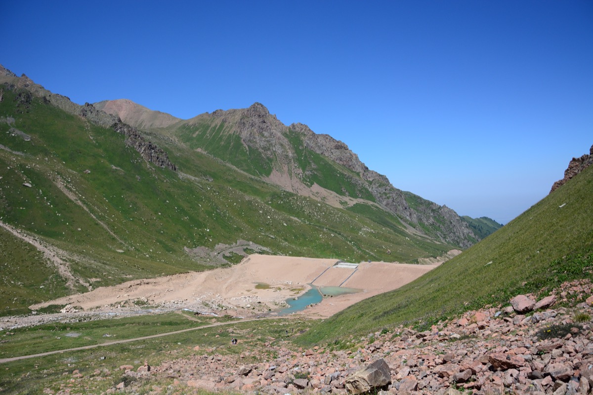
The name translates from Kazakh as "a thousand horses"—this used to be a pasture, broad and grassy enough to feed an entire herd. The flat valley floor is a legacy of glaciers. Thousands of years ago, more powerful ice flows moved through here, and after their retreat, a wide moraine remained, upon which the present plateau now lies. The valley stretches approximately 4 km, wedged between steep slopes and surrounded on all sides by glaciers, including Turgen. Since 1936, a meteorological station has operated on the plateau—one of the oldest high-altitude stations in the region. Observations have been conducted continuously for nearly nine decades. Here, at an elevation of 3020 meters, stands an anti-debris flow dam—17 meters high and 300 meters long, designed to hold nearly a quarter million cubic meters of water. The dam was built to hold back debris flows that can be generated by meltwater from glaciers higher up on the slope.
Mynzhylki is not an end destination but rather a base camp: from here, trails branch out further into the mountains. This section of the Ile-Alatau is generally considered the birthplace of Kazakhstani alpinism. It was precisely in the Turgen area that the first mountaineering camps were established in the 1930s. At that time, local climbers began conquering the surrounding four-thousand-meter peaks, including Talgar—the highest point of the range, first summited in 1935. One of the most popular routes in the area passes through the plateau—to Titov Pass and Peak, with access to Titov Lakes, Gorelnik Waterfalls, and descent to Medeu. Another direction leads to the Turgen Glacier, from where genuine mountaineering routes begin—for example, to Pogrebetsky Peak, with difficulty grades ranging from 1B to 3A. So in summer, the plateau is always busy: day-trippers and mountaineers headed for more serious climbs meet here. At night, the plateau is noticeably colder than in the city, even in summer—a temperature difference of 15–20 degrees is common. Trekking boots, a windproof jacket, and sunglasses are sufficient gear: at such an altitude, the sun feels considerably more intense than at lower elevations.