 Mountains & WalksMountains & Walks
Photo: VadimYap, CC BY 4.0 · source
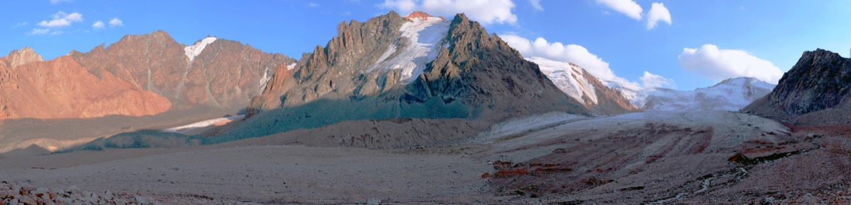
From the upper station of Shymbulak to the tongue of Tuyuksu Glacier is another 8 km beyond the route to Mynzhylky plateau. The total round trip is approximately 16 km with an elevation gain of around 1250 meters. It's a long hike, lasting 7–11 hours, but not technically demanding: ordinary trekking boots and poles are sufficient to reach the glacier tongue and T1 station. Crampons and ropes are needed only for those continuing higher to Tuyuksu Pass, which is a much more serious route. The best time to hike is from May to October in clear weather: at such altitude, clouds can obscure the trail even in summer.
The name translates from Kazakh roughly as "stagnant water" — unlike many neighboring glaciers whose melt streams rush down as torrential rivers. The glacier was first described in 1902 when researcher S. E. Dmitriev documented its boundaries and elevation. During the 1920s and 1930s, the first scientific expeditions came here. N. N. Palgov worked here from 1922–1926, and G. R. Yunusov from 1937–1938; both conducted surveys and observations. In 1956, a glaciological station T1 was established on the glacier — one of the oldest in the world. Continuous monitoring of the ice conditions continues here to this day. After the Soviet Union's collapse, most similar stations in the region were closed, but T1 continued its work. Today, the fluctuations of Tuyuksu serve as the indicator for the condition of all glaciers in Central Asia — it is the most studied glacier in the entire CIS. No other place in the world has such a long and uninterrupted series of observations. The glacier has another merit that is rarely mentioned: the Malaya Almaty River originates from it. It was on the banks of this river in 1854 that Major Peremyshelsky's detachment chose the location for the Zailiysky fortress — the future Alma-Ata. So the city owes its location in part to the meltwater from this very glacier.
The exposed part of the glacier stretches for 3.5 km with a width of up to 1.5 km in the upper cirque, narrowing to 300–400 meters at the tongue. The average ice thickness is around 50 meters, reaching 100 meters in some places. But the most important finding from observations is visible even without instruments: the glacier is retreating rapidly. Since 1958, it has lost approximately 57 million cubic meters of ice, and its length has been cut in half — from four kilometers to two. On average, the glacier tongue retreats approximately 10 meters per year. According to glaciologists' forecasts, at the current rate of warming, it could disappear almost completely by mid-century. For now, the glacier's cirque, framed by rocky peaks, remains one of the most spectacular places in the Alma-Ata vicinity. It may be worth seeing it now rather than postponing the hike for later.